15 November 2014 | Seoul Trail Information
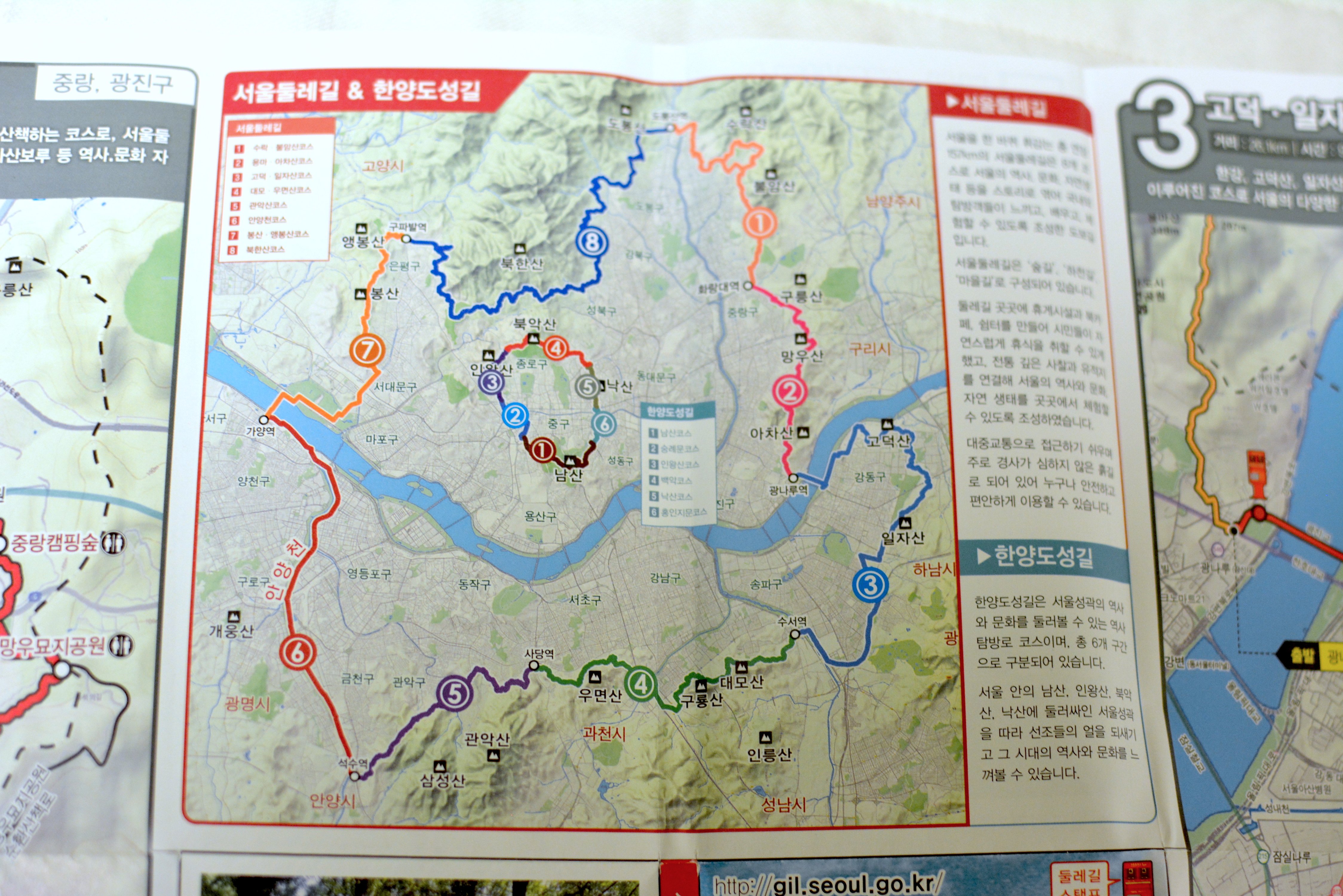
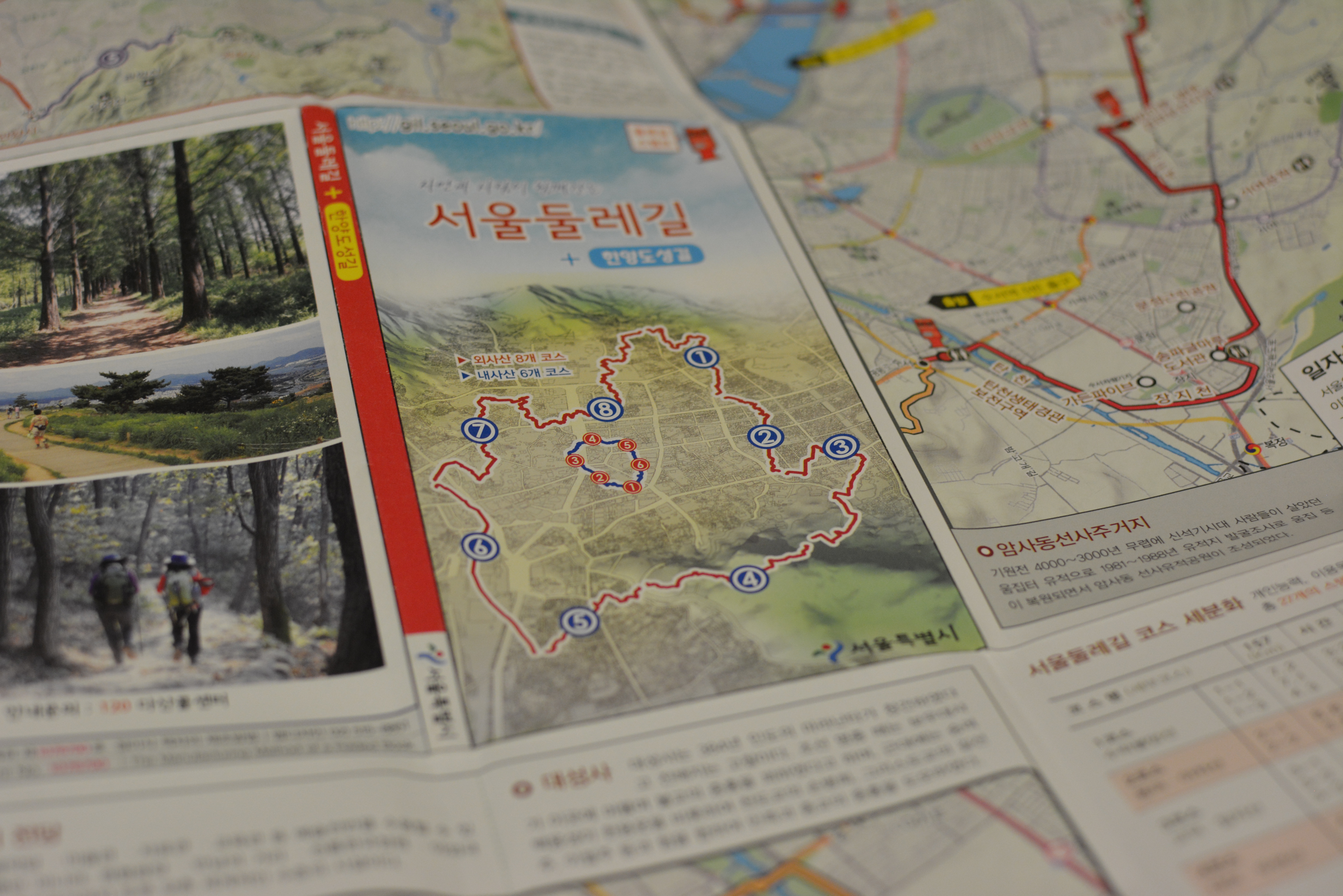
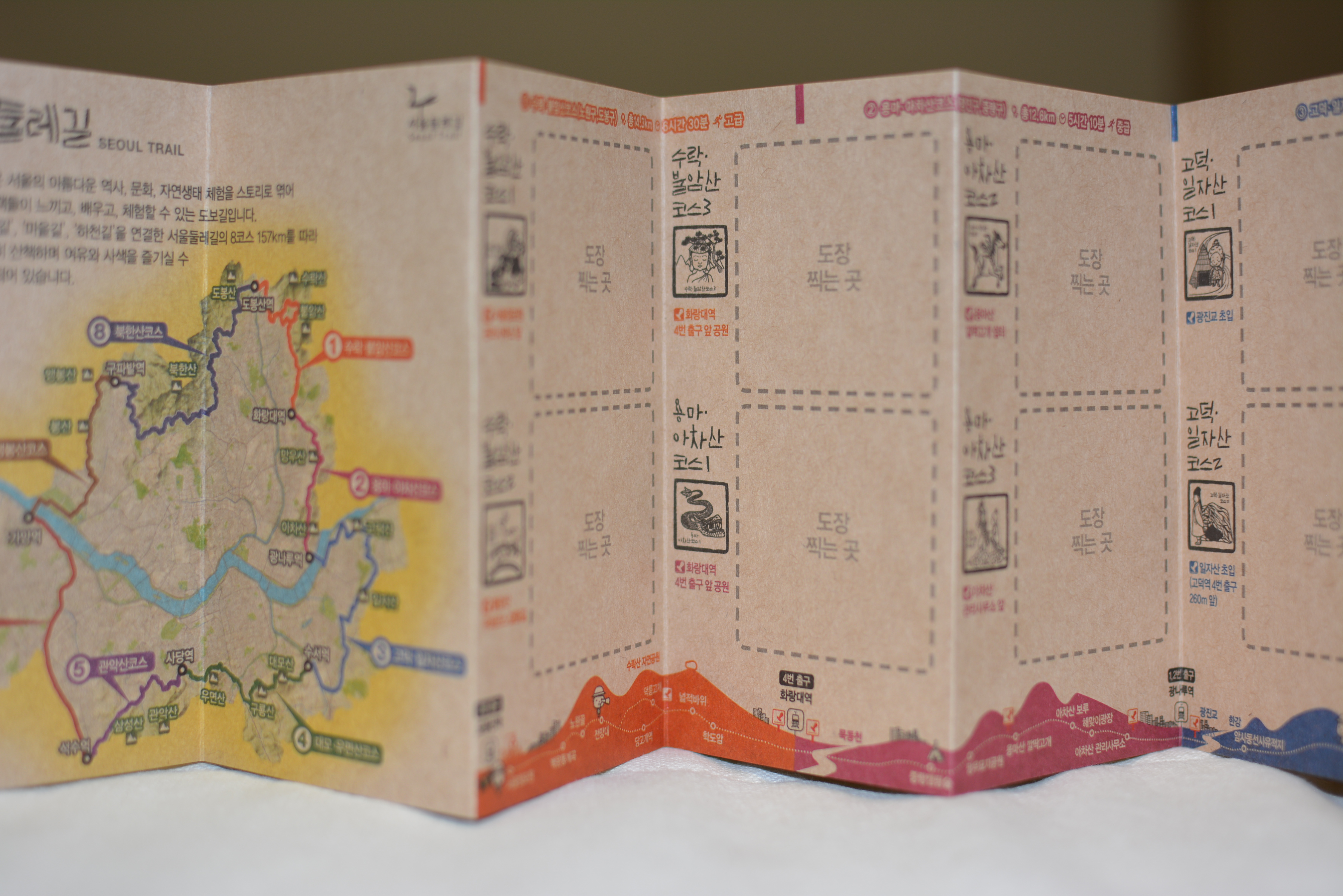
Seoul Dulegil (Seoul Trail) is a 157km trail with 8 Courses that goes around the City of Seoul that fully opened to the public today November 15, 2014. The city will issue certificates to those who complete all of the eight courses and get the rubber stamps from the 27 stamping stations made from recycled mailboxes along the trail.
8 Courses, 27 Stamps, 157 km trail, 23 subway stations near the trail for easy access
More information is available:
Seoul Trail: gil.seoul.go.kr/walk/sub/introduce/guide.jsp (Korean only)
Seoul Trail Course 1 to 8: http://gil.seoul.go.kr/walk/sub/course/total_course.jsp (Korean only)
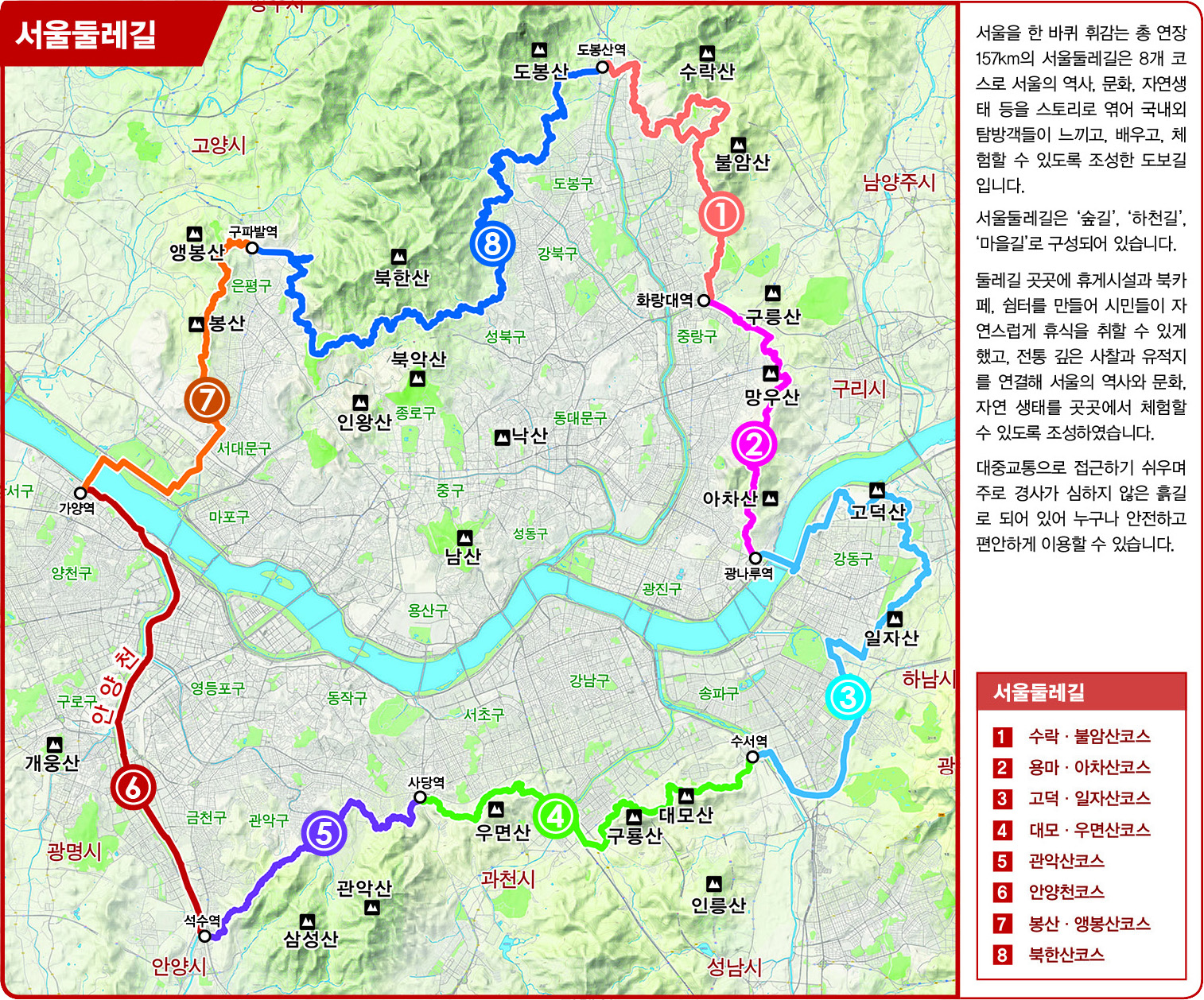
Map of the 8 courses:
Map and Stamp book are available at the Seoul City Hall (Civil Office on the Main floor, office is to the right)
Map to go:
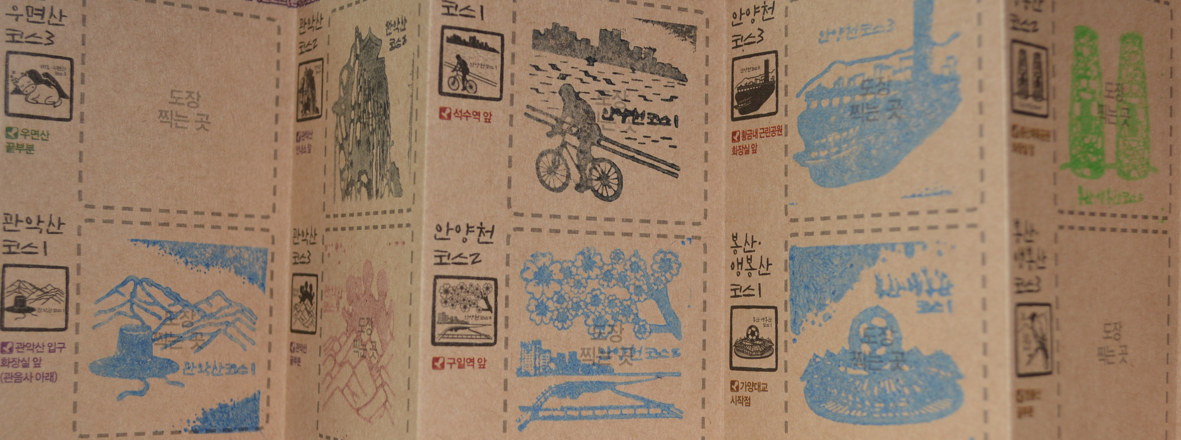
Stamp book: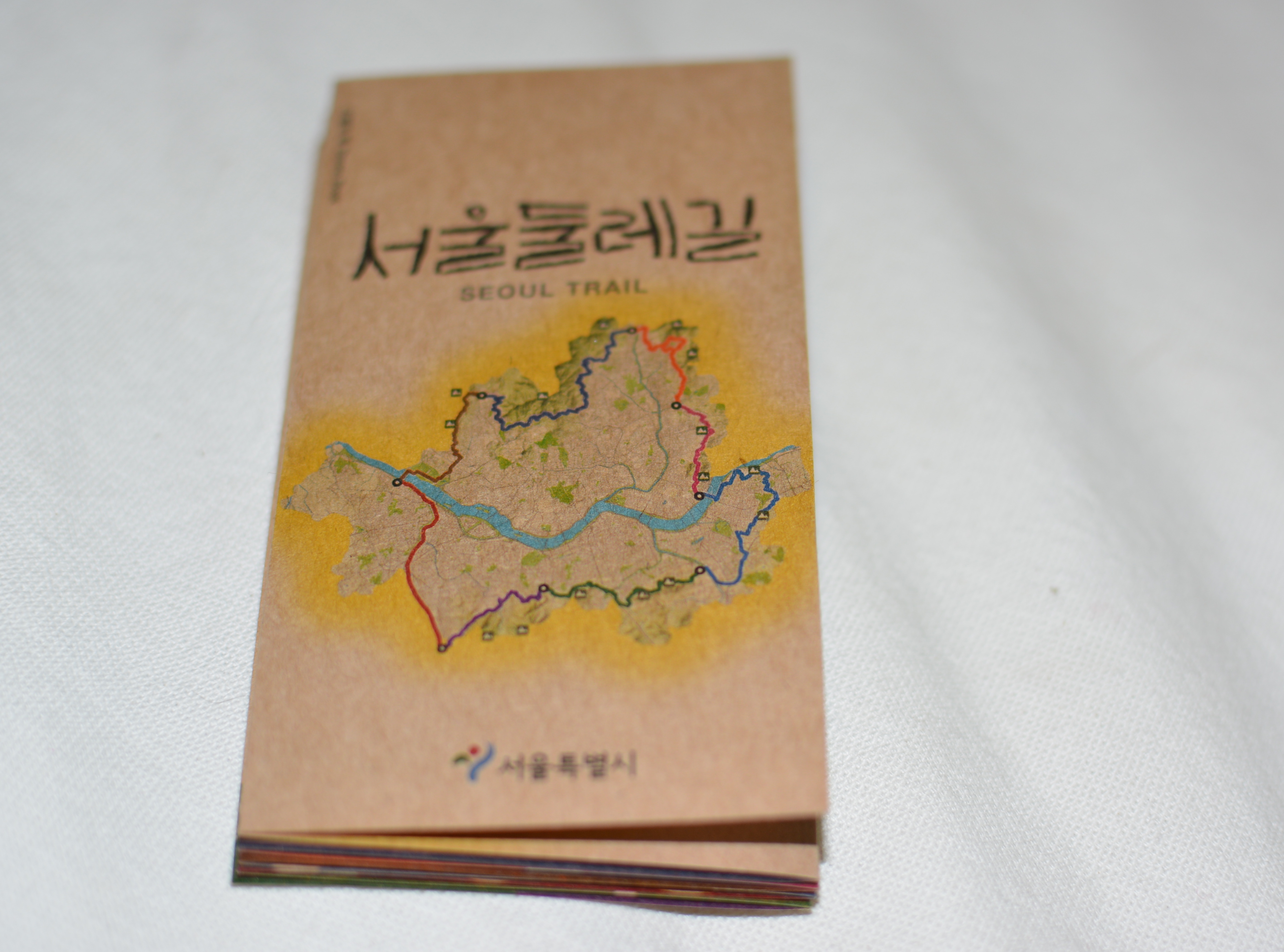
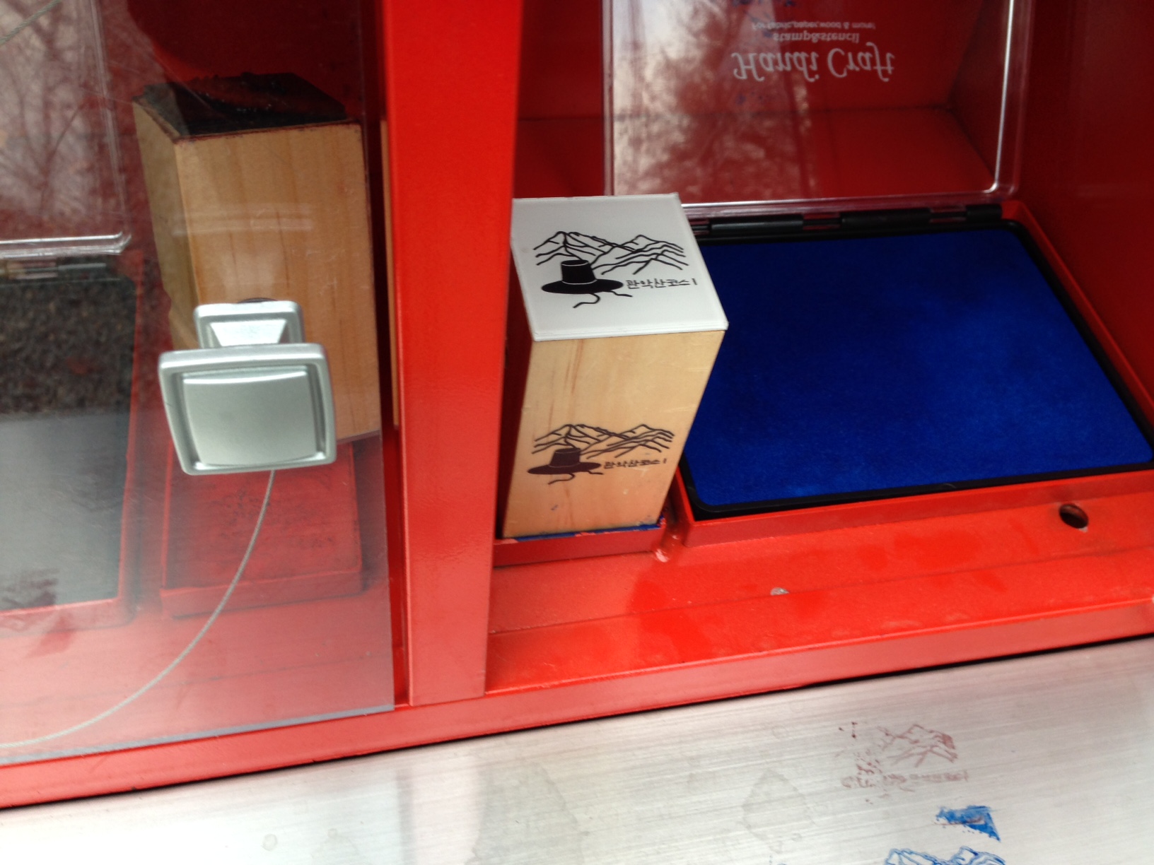
Stamp Booth: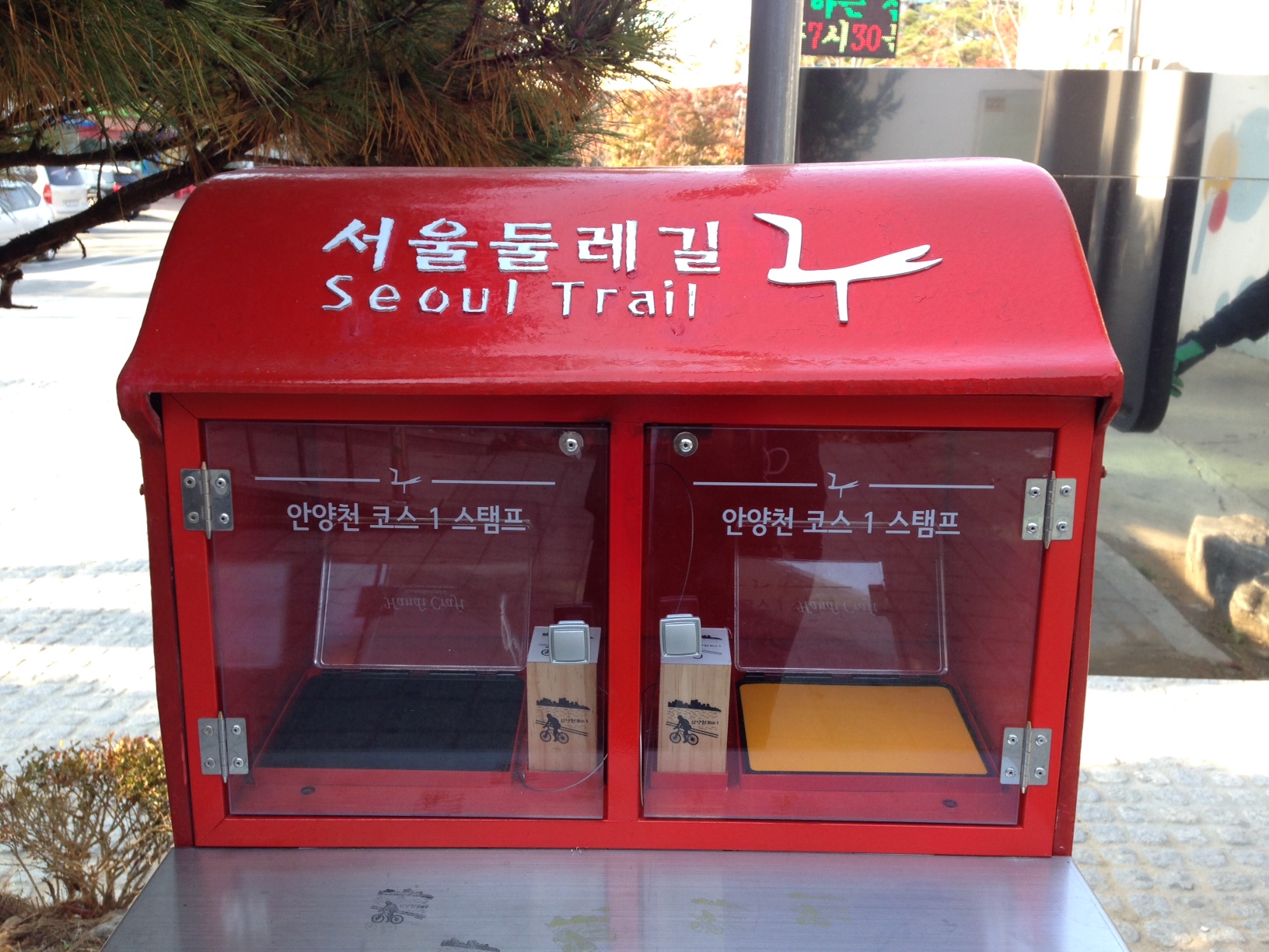
Follow these Signs: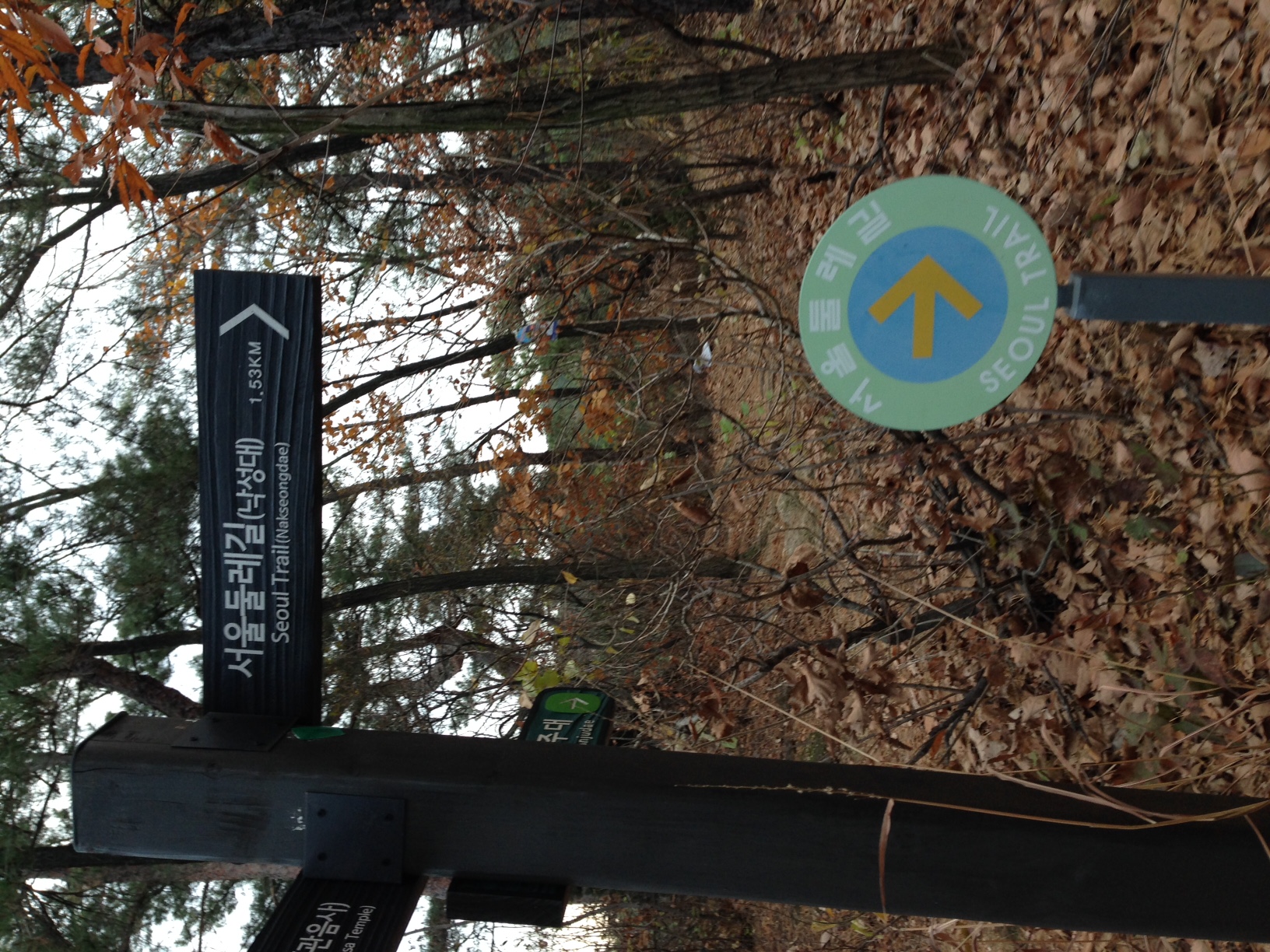
Enjoy and stay safe!
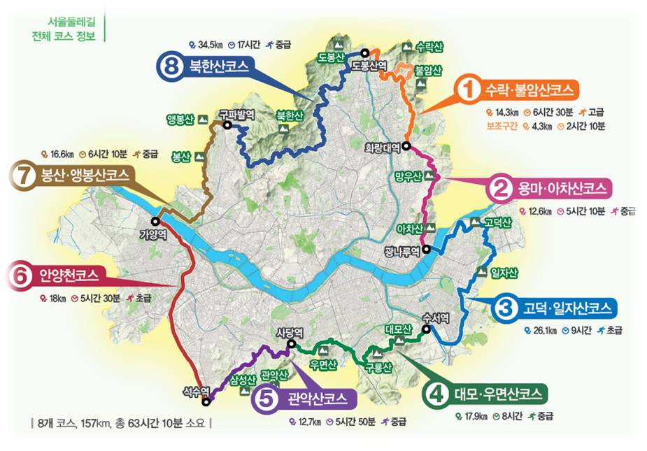
Routes
Course 1 (Suraksan Mountain – Buramsan Mountain / total 8.6km / 3 sections)
Dobongsan Station (Seoul Subway Line 1, 7) – Danggogae Station (Seoul Subway Line 4) /
Danggogae Station (Seoul Subway Line 4) – Hwarangdae Station (Seoul Subway Line 6) /
Detour course
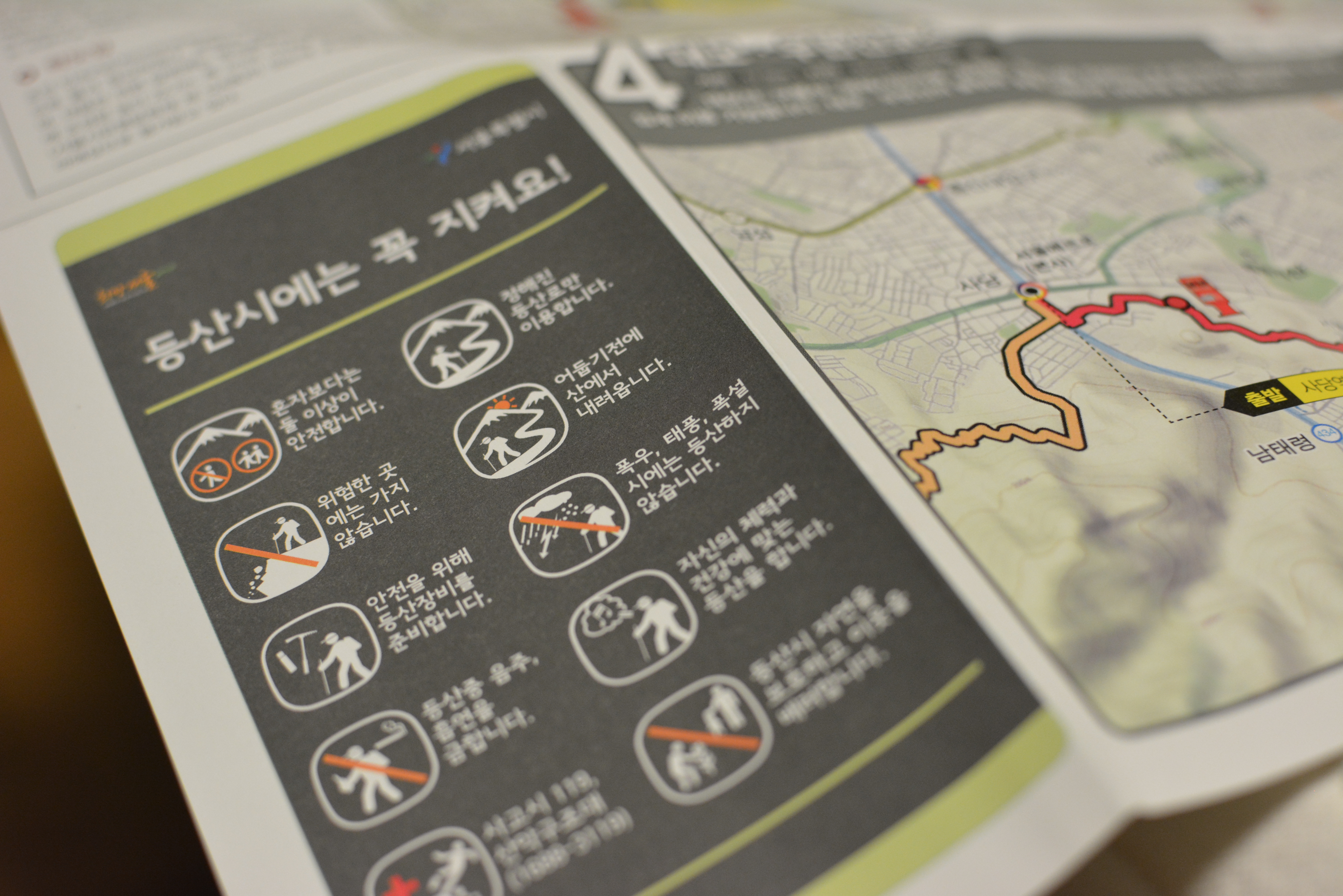
* Note: detour course is designed for mountain climbing; not recommended for people wishing to
walk for light exercise.
Course 2 (Yongmasan Mountain – Achasan Mountain / total 12.6km / 2 sections)
Hwarangdae Station (Seoul Subway Line 6) – Sagajeong Station (Seoul Subway Line 7) /
Sagajeong Station (Seoul Subway Line 7) – Gwangnaru Station (Seoul Subway Line 5)
Course 3 (Godeoksan Mountain – Iljasan Mountain / total 26.1km / 3 sections)
Gwangnaru Station (Seoul Subway Line 5) – Godeok Station (Seoul Subway Line 5) /
Godeok Station (Seoul Subway Line 5) – Olympic Park Station (Seoul Subway Line 5) /
Olympic Park Station (Seoul Subway Line 5) – Suseo Station (Seoul Subway Line 3, Bundang Line)
Course 4 (Daemosan Mountain – Umyeonsan Mountain / total 17.9km / 2 sections)
Suseo Station (Seoul Subway Line 3, Bundang Line) – Yangjae Citizen’s Forest Station
(Sinbundang Line) / Yangjae Citizen’s Forest Station (Sinbundang Line) – Sadang Station
(Seoul Subway Line 2, 4)
Course 5 (Gwanaksan Mountain / total 12.7km, 2 sections)
Sadang Station (Seoul Subway Line 2, 4) – Seoul Nat’l Univ. Station (Seoul Subway Line 2) /
Seoul Nat’l Univ. Station (Seoul Subway Line 2) – Seoksu Station (Seoul Subway Line 1)
Course 6 (Anyangcheon Stream / total 18km, 2 sections)
Seoksu Station (Seoul Subway Line 1) – Guil Station (Seoul Subway Line 1) / Guil Station
(Seoul Subway Line 1) – Gayang Station (Seoul Subway Line 9)
Course 7 (Bongsan Mountain – Aengbongsan Mountain/ total 16.6km, 2 sections)
Gayang Station (Seoul Subway Line 9) – Jeungsan Station (Seoul Subway Line 6) /
Jeungsan Station (Seoul Subway Line 6) – Gupabal Station (Seoul Subway Line 3)
Course 8 (Bukhansan Mountain / total 34.5km / 11 sections)
Gureumjeongwon-gil, Yetseong-gil, Pyeongchangmaeul-gil, Myeongsang-gil, Solsaem-gil,
Huingureum-gil, Sullye-gil Road, (Pine tree forest) Sonamusup-gil,
(Royal tombs) Wangsilmyoyeok-gil, Banghak-dong-gil, Dobongyet-gil
Resources:
Seoul Trail: gil.seoul.go.kr/walk/sub/introduce/guide.jsp (Korean only)
Seoul Trail Course 1 to 8: http://gil.seoul.go.kr/walk/sub/course/total_course.jsp (Korean only)
Seoul Trail Article: http://asiaenglish.visitkorea.or.kr/ena/FU/FU_EN_15.jsp?cid=1964997
Bukhansan National Park: main.knps.or.kr/ (Korean, English, Japanese, Chinese)